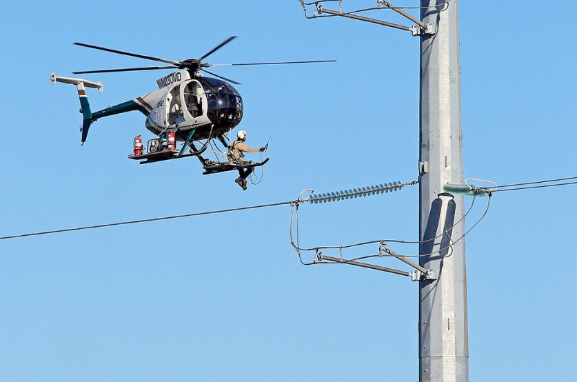
Have you ever wondered how power companies ensure the safety and efficiency of their powerline infrastructure? One innovative method that has been gaining popularity is the use of helicopters for powerline surveys. In this article, we will explore the fascinating world of powerline surveys conducted by helicopters in Florida.
The Role of Helicopters in Powerline Surveys
Aerial Perspective
Helicopters provide a unique aerial perspective that allows power companies to thoroughly inspect their powerline infrastructure. From the sky, surveyors can easily identify potential hazards such as damaged powerlines, leaning poles, or encroaching vegetation. This bird’s-eye view enables quick and accurate assessments, ensuring that any issues are promptly addressed.
Efficiency and Speed
Traditional ground inspections of powerlines can be time-consuming and labor-intensive. Helicopter surveys, on the other hand, offer unparalleled efficiency and speed. With the ability to cover large distances in a short amount of time, power companies can assess a significant portion of their infrastructure in a single day. This efficiency not only saves time but also reduces costs associated with manual inspections.
Enhanced Safety
Safety is a top priority when it comes to powerline maintenance. Helicopter surveys provide a safer alternative to ground inspections, particularly in challenging terrains or areas with limited accessibility. Surveyors can avoid potential dangers such as uneven terrain, dense forests, or swampy areas, ensuring their well-being while conducting inspections. Additionally, helicopters equipped with advanced technology can detect electrical faults and potential hazards from a safe distance, minimizing the risk of accidents.
The Process of Powerline Survey by Florida Helicopter
Pre-flight Planning
Before conducting a powerline survey, thorough pre-flight planning is essential. This includes reviewing maps, identifying the specific areas to be surveyed, and coordinating with air traffic control to ensure a smooth operation. The pilot and surveyors also conduct a comprehensive safety briefing, outlining emergency procedures and communication protocols.
Survey Equipment
Helicopters used for powerline surveys are equipped with specialized equipment to capture detailed data. High-resolution cameras, LiDAR sensors, and infrared imaging are commonly used to gather information about the condition of powerlines and surrounding vegetation. This data is then analyzed to identify potential issues and plan necessary maintenance or repairs.
Data Analysis and Reporting
Once the survey is completed, the collected data is carefully analyzed by experts. This analysis involves identifying any anomalies or potential hazards that may require immediate attention. Detailed reports are then generated, highlighting the findings, recommended actions, and timelines for resolution. This information is crucial for power companies to prioritize maintenance tasks and ensure the continued safety and reliability of their powerline infrastructure.
Conclusion
Powerline surveys conducted by helicopters in Florida have revolutionized the way power companies ensure the safety and efficiency of their infrastructure. With the ability to quickly and accurately assess powerlines from an aerial perspective, helicopters provide an invaluable tool for maintaining reliable electricity supply. By embracing this innovative approach, power companies can stay one step ahead in identifying and addressing potential issues, ultimately benefiting both their customers and the environment.


